| The subject of this article is from the Frontiers update.
The information from this article is up-to-date as of 15 February, 2022. |
The information from this article is up-to-date as of 15 February, 2022.
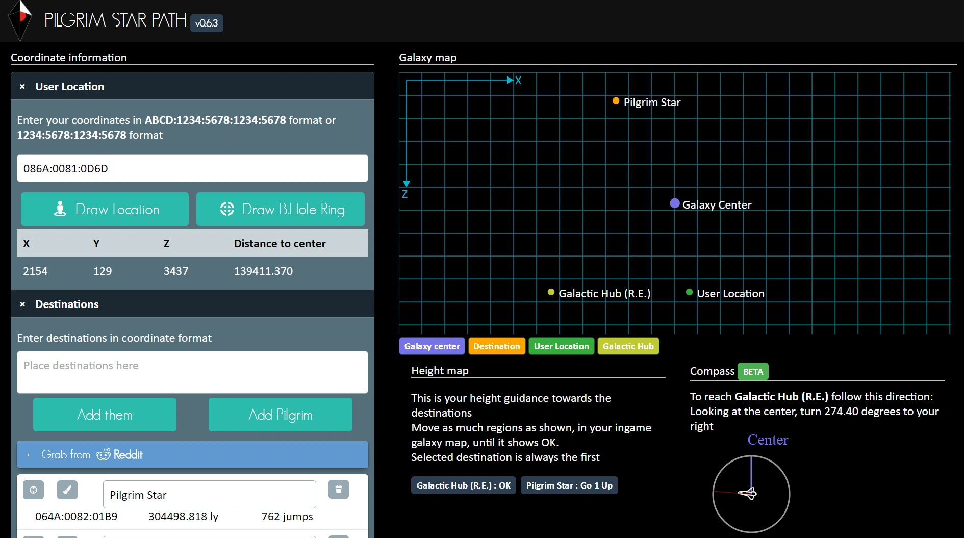
Pilgrim Star Path by: pahefu
The Coordinate Plotting Application (App) converts data from a Signal Booster.
Summary[ | ]
A Coordinate Plotting Application (App) converts the data string from Signal Boosters into x,z,y coordinates and plots their location on a map that can be used for short and long range galactic voyages.
The applications are an essential tool for the Alliance of Galactic Travellers and anyone interested in travelling long range in No Man's Sky.
Signal boosters[ | ]
When placed on a planet or moon every Signal Booster emits a code when approached. It looks something like this one from the video below: HUKYA:046A:0081:0D6D:0038
The 3 sections in the middle (046A:0081:0D6D) can be entered into a Coordinate Plotting App such as the Pilgrim Star Path by: pahefu or No Man's Connect - Online Location Manager by: jaszhix
Applications[ | ]
The Pilgrim Star Process can be used in conjunction with Signal Booster coordinates and the Pilgrim Star Path to manually navigate and travel across the Euclid galaxy.
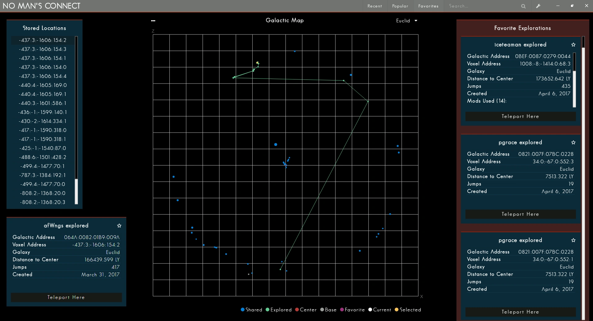
No Man's Connect - Online Location Manager by: jaszhix
No Man's Connect is an ancillary program (.exe) location manager that syncs your current game's coordinates, uploads them to a server and indexes a list of everyone's coordinates using the app. When launched, the program displays a map that plots your coordinates and allows you to teleport to any location in the applications database. It is easily possible to manually add a coordinate location in any of the 256 galaxies to the database and then teleport instantly in your save file to that location.
Videos[ | ]
The IVc Project prepared a tutorial video on the use of a signal booster to retrieve coordinates in a game session.
Guide to use NMS connect: